


Research

Let's Discover Wildlife Together!
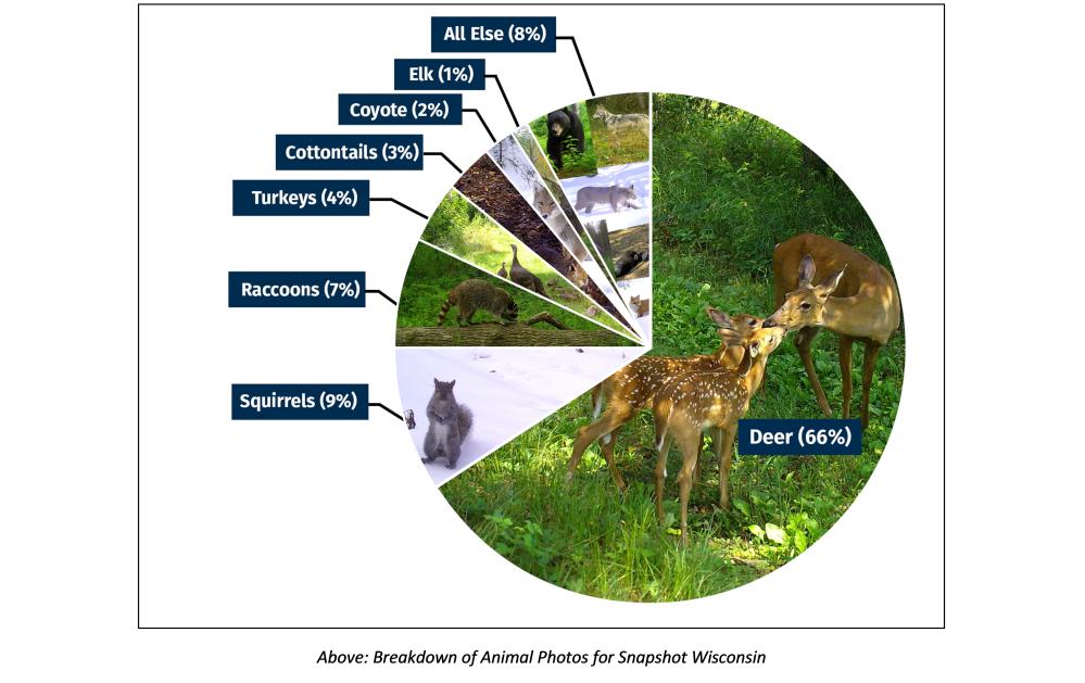
Wisconsin is a state in the Great Lakes region of the United States that hosts a variety of habitats from coniferous forest to prairies. Snapshot Wisconsin is a community science project with the Wisconsin Department of Natural Resources (WDNR) and volunteers to monitor wildlife using a statewide network of trail cameras. Volunteers host trail cameras, which are triggered by the heat and movement of passing animals, thus providing a manner of wildlife monitoring. Wisconsin is home 65 species of native mammals, hundreds of other vertebrate species, and thousands of invertebrates and native plant species, living together in diverse natural communities. The Wisconsin Department of Natural Resources (WDNR) manages wildlife in partnership with individuals and organizations. Please visit our WDNR website to view our requirements to host a trail camera, sign up for our Snapshot newsletter, or explore Snapshot in the classroom!
Snapshot Wisconsin Project Goals
The project goals for Snapshot Wisconsin are to:
- Provide novel opportunities for public engagement with natural resources.
- Provide data needed to make wildlife management decisions and improved wildlife survey efficiency.
- Further the science of trail camera monitoring for understanding wildlife populations, behavior, and wildlife interactions.
Snapshot Wisconsin data are integrated into wildlife decision making for deer and wolves. There are on-going research projects to develop catch-per-unit-effort metrics for all species and hen-to-poult ratios for turkeys. Snapshot Wisconsin data have been used to understand how deer behavior changes throughout the winter when there are especially cold and warm days. Also, Snapshot Wisconsin data led to the finding that species interactions are more compressed in landscapes with more human impact. Visit the Results page for links to publications and more information.
 |
Snapshot Wisconsin Data Dashboard
Check out the Snapshot Wisconsin Data Dashboard. Back in 2020, the Snapshot Wisconsin Data Dashboard was launched! The Dashboard provides readily available data from the project to the general public, as well as gives our volunteers insight into how their efforts fit in to the larger picture across the state. The Data Dashboard includes viewing a range of data from 2017 to 2024 from 22 different species. You're able to adjust visualization for each species which includes map visualizations (state vs. county, ecological landscape), by hour, by month, detections over a year, and you're able to download the data for personal use or classroom use!
 |
Why Snapshot Wisconsin Needs Your Help!
A single trail camera can take thousands of photographs each month. Zooniverse users help to make all these photos meaningful by classifying the type and number of animals in each. Because we know where and when these photos were taken, we can create maps for both common and rare species across the state and visualize how animal populations change through time.
Monitoring wildlife is important because it provides insight into the population and distribution of a species. With this information, the WDNR along with partners can make informed decisions about managing wildlife in Wisconsin. However, to make these photos meaningful, the type and number of animals in each photo needs to be classified. That’s where you come in! With your help, we have classified millions of photos and helped the wildlife of Wisconsin. To all our volunteers, whether you host a camera or help classify photos on Zooniverse, Thank you!