


Finished! Looks like this project is out of data at the moment!
Research
Welcome to Planet Four: Ridges!
Slow and steady wind erosion on Mars has created a wide variety of inverted terrains, including crater floors that are now the tops of mesas, river channel bottoms that now define ridges, and lava flows now that stand in relief. One unusual type of inverted topography is known as a "polygonal ridge network” or rectilinear ridges. These polygonal ridge networks can be formed through a variety of processes, including:
- Minerals deposited by groundwater flowing through fractures
- Energy from a meteorite impact breaking rocks into fragments and pushing them through the surrounding rocks
- Magma coming up from below and creating webs of dikes
- Lava flowing into pre-existing fractures
- Dust and debris being blown into open fractures by the wind.
In each case, after the ridge network is made, it is exposed over many years of action by the wind.
Scientists have mapped these polygonal ridge networks across much of Mars. In particular, ridges are especially common in two vast regions of Mars called Arabia Terra and Sinus Meridiani. They have noticed that some areas are covered with ridge networks, some have one or two isolated ridges, and others show no evidence for ridges at all. The science team would like to know their distribution and try to figure out if it is correlated with other variables, such as ancient Noachian (~4.1- 3.7 billion year old) terrains, fine-grained materials, or hydrated minerals to better understand how they form on Mars.
We need your help to map where these polgyonal ridges occur. You will be looking for networks of ridges that intersect to making a polygonal, spider-web-like pattern. The images you will analyze are from the Context Camera orbiting Mars. Additionally the locations you identify will serve as likely future targets for higher resolution observations.

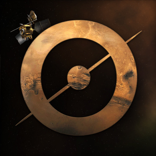
Hubble Space Telescope Image of Mars. Arabia Terra is the large triangular shaped region in the center. Sinus Meridiani can be seen as the darker region below Arabia Terra. Image Credit: NASA, ESA, and L. Frattare (STScI)
How do polygonal ridge networks form?
Planetary scientists have several hypotheses for how polygonal networks form, and it is possible that different networks for in different ways. Ridge networks commonly form by the filling of a polygonal fracture network. The filling material can be dust or sand that blows into the cracks, minerals deposited by liquid water circulating through the cracks, or lava flowing into the crack network. Once deposited, the crack-filling material hardens and becomes harder to erode than the material around it. Slow and steady wind erosion can exposed these mineral-filled fractures as networks of intersecting ridges up to tens of meters in height. We would like your help to map where these types of ridge networks occur. You will be looking for networks of ridges that intersect to making a polygonal, spider-web-like pattern. The Planet Four: Ridges science team would like to know how these ridges form on Mars. With your help, we can map their distribution and try to figure out if the polygonal ridges are correlated with other variables, such as ancient Noachian terrains, fine-grained materials, or hydrated minerals.

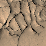
Ridges of different thicknesses found in the Arabia Terra region. These ridges are thought to form due to warm, mineral-laden groundwater circulating through the ancient Martian crust. Image Credit:NASA/JPL-Caltech/Malin Space Science System.

Ways to form a Polygonal Ridge Network – Figure from Kerber et al., 2017.

The variety of polygonal ridge networks - Image Credit:NASA/JPL-Caltech/Malin Space Science System
CTX (Context Camera)
The images you see on Planet Four: Ridges come from the Context Camera (nicknamed CTX) orbiting Mars right now aboard NASA’s Mars Reconnaissance Orbiter (MRO). As its name implies, CTX provides context for images acquired by other instruments onboard MRO. It creates images at 6 meters per pixel scale over a swath 30 kilometers wide. CTX is the ideal instrument for our search, combining large areal coverage with sufficient spatial resolution to identify polygonal ridges.
Planet Four and Planet Four: Terrains
Planet Four: Ridges is a spinoff from the Planet Four and Planet Four: Terrains Mars citizen science projects. With Planet Four, volunteers map the size, shape, and direction of dark fans and blotches produced by the carbon dioxide jets on a thawing carbon dioxide ice sheet and later sculpted by local surface winds. With Planet Four: Terrains, volunteers are helping to identify terrains mainly created by the repeated deposition and thawing of carbon dioxide ice, in images from the CTX camera.