


Research
Natural history collections preserve an extraordinary record of life on Earth. Each specimen represents an observation of a species at a particular place and time, often documenting locations that may have changed dramatically over decades or even centuries. While many specimens have been georeferenced, a large portion of their geographic information remains locked within textual locality descriptions.
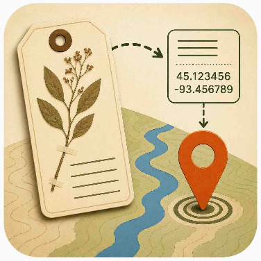
Georeferencing transforms these descriptions into geographic coordinates accompanied by estimates of spatial uncertainty. This process allows researchers to integrate specimen data with modern geographic information systems, climate datasets, satellite imagery, and ecological models and more.
Georeferenced biodiversity data support a wide range of scientific applications, including:
• Mapping species distributions and biodiversity hotspots
• Modeling how species ranges respond to climate change
• Identifying areas of conservation importance
• Detecting invasive species and emerging threats
• Studying historical changes in ecosystems and land use
• Supporting environmental management and restoration projects
• Improving biodiversity databases used by researchers worldwide
This project also serves as a demonstration of new mapping infrastructure being developed for the Zooniverse platform more broadly. The project introduces a map-based classification experience that allows volunteers to interact directly with geographic information and maps while contributing to scientific research. These tools are designed to make georeferencing more efficient, accessible, and accurate.
The project further explores the integration of Notes from Nature with GEOLocate, a widely used georeferencing platform that combines geographic expertise with advanced computational methods. By creating a seamless workflow between citizen scientists and georeferencing technology, we aim to increase the volume and quality of georeferenced specimen records available through open-access biodiversity data networks.
The resulting data will be shared through biodiversity repositories and research platforms where they can be used by scientists, educators, conservation organizations, government agencies, and the public. By participating, volunteers are helping build critical infrastructure for biodiversity science while contributing directly to research that improves our understanding of the natural world.
Every locality you help interpret adds another point to our collective map of life on Earth.
Our work to develop new mapping tools for the Zooniverse platform is supported by the U.S. National Science Foundation, awards #2513443 and #2513444.
