

Help georeference museum specimen records by matching locality descriptions to places on a map. Your contributions will help create high-quality geographic data that support biodiversity research, conservation planning, ecological modeling, and our understanding of life on Earth.
Learn more"PRACTICE: Putting Biodiversity on the Map" is a good place to start if you are new to georeferencing. This expedition is meant to help you get more familiar with the tool and the data is not saved.
Zooniverse Talk
Chat with the research team and other volunteers!
Notes from Nature - Putting Biodiversity on the Map Statistics
View more statsAll Time Stats
Active Stats
Active stats provide information about currently active workflows and subjects.
Message from the researcher
Every specimen has a story, but without a location, part of that story is missing. Your contributions help place biodiversity on the map and make these collections more valuable for everyone.
MichaelAbout Notes from Nature - Putting Biodiversity on the Map
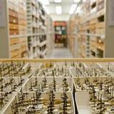
Natural history collections preserve billions of specimens that provide an irreplaceable record of where species have lived and how biodiversity has changed over time. Scientists use specimen data to study species distributions, track environmental change, identify conservation priorities, and understand how ecosystems respond to changing conditions.
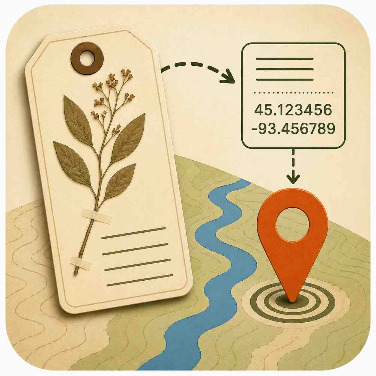
Many specimen records contain valuable location information recorded by collectors, but these data often exist only as written descriptions. To make these records more useful for research, they must be georeferenced. Georeferencing is the process of converting a locality description into geographic coordinates and an estimate of location uncertainty.
In this project, you will help georeference museum specimen records using new mapping tools integrated directly into the Notes from Nature workflow. By exploring maps and interpreting locality descriptions, you will help identify where specimens were collected and improve the quality of biodiversity data available to researchers worldwide.
Your work also contributes to the development of new mapping infrastructure within Zooniverse, creating more effective ways for volunteers and researchers to collaborate on geographic data. Every georeferenced record becomes part of a growing resource that supports scientific discovery, conservation efforts, education, and open-access biodiversity research.
Whether you are an experienced mapper, a natural history enthusiast, or simply curious about the world, your contributions will help unlock the scientific value of museum collections and make these important data available for future generations.