


Finished! Looks like this project is out of data at the moment!
We're happy to announce that our preprint is out, describing our tree mapping research and the (now public) dataset that this project uses! You can find it on arXiv here and check out the models for yourself here. Thanks again for volunteering, your efforts are helping us improve our labels and ultimately improve the state of tree and restoration monitoring.
We've completed the classification stage for this project! To browse other active projects that still need your classifications, check out zooniverse.org/projects.
Research
Why restore and conserve forests?
Humanity needs more restoration and conservation to tackle the interconnected biodiversity, climate and poverty crises. The potential is huge to prevent species extinction, improve food security, and sequester more CO2.
There is space available for one billion hectares of additional forest on the planet right now.
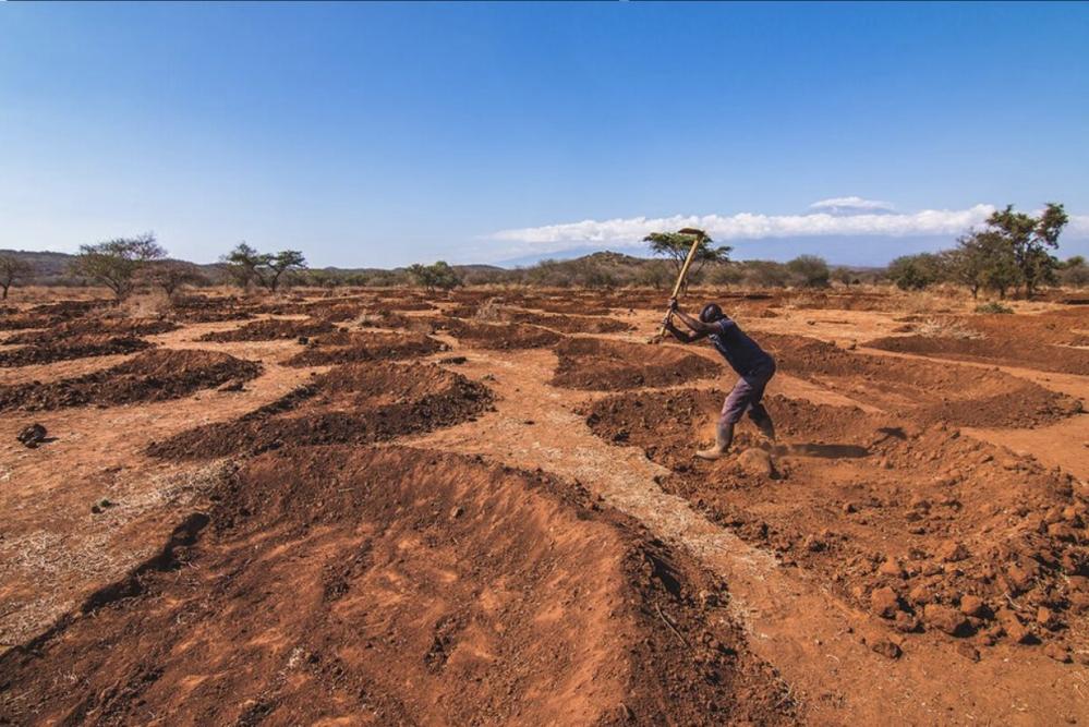
Credit: Preparation for a tree planting project in Tanzania, Justdiggit
Finance for nature restoration
One of the major enabling factors for the work on the ground will be funding for restoration. Finance, however, needs to be unlocked first.
Funders want to know if “their” trees grow, where “their” carbon is sequestered, “if” they are having an impact on biodiversity and climate and livelihoods and how the impact can be quantified.
Restor wants to help unlock the funding by creating more transparency in the space, which will lead to increased trust in the restoration work on the ground.
High tech for nature
Using drones, restoration groups can show their impact on the ground. One of the simplest ways to measure restoration success is to monitor a site over multiple years and observe if there is increasing forest cover.
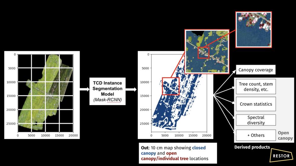
Restor is developing an AI model to identify trees from drone imagery, as well as measure the size of tree crowns.This is called tree crown delineation. From this, we can check if the trees are still there, and how they are growing. This model will be released publicly.
Below is an example of trees and tree cover detected by our model (the green polygons) over a restoration area in Tanzania.
A global approach
There are few publicly available models for high resolution (sub-metre) individual tree detection and those that do exist are trained in limited geographic regions (a single country or biome). These models struggle to generalise beyond the regions that they were trained in and this is a challenge as restoration is a global movement.
We carefully selected imagery from all over the world that cover multiple types of biome. When released, our dataset will be one of the largest and most diverse available for tree detection. With your help, we can make it even better!
Our tree crown delineation project
For more information about our project generally, you can have a look at this slideshow: https://docs.google.com/presentation/d/18HaHhAPR4Pq3nOlFcnWbcguuMDmtVjLhPdydlPWmO2I/edit?usp=sharing
It contains details about the dataset that we've collected, the models that we've trained and gives some results.
We are preparing our detection models and dataset for publication and, under the terms of our funding agreement with Google.org, it will be released under a permissive open-source license later this year. If you are interested in running our model on your data, please do get in touch.
All our training data is sourced from Open Aerial Map, or from restoration partners who have granted us permission to use their drone imagery.
This is an overview of our current data pipeline, that we use to process user-provided drone imagery:
Why do we need your help?
We want to be transparent about where our models work, and where they don’t. In order to answer this question we evaluate our models on “ground truth” data - imagery where we know exactly, or with very high confidence, where trees are located.