


Finished! Looks like this project is out of data at the moment!
FAQ
Frequently Asked Questions
What are you asking me to do?
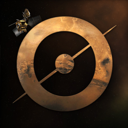
We are asking you to review images of Mars' south pole taken from orbit and to identify terrains that are mainly formed by the thawing of carbon dioxide and water ices present in the polar ice cap during the Southern spring and early summer. The images you will be reviewing were taken with the Mars Reconnaissance Orbiter Context Imager (CTX). With your help, we'll find new interesting areas of Mars to image with HiRISE (High Resolution Imaging Science Experiment), the highest resolution camera ever sent to a planet. With HiRISE, we can study these new regions of interest in detail and examine how they change over time. Learn more on the Research Page and in the Spotter's guide
Where do the images come from?
The images you see on Planet Four: Terrains come from the Context Camera (CTX) aboard Mars Reconnaissance Orbiter (MRO). The Context Camera takes wide view images (~30 km x ~60 km) of the Martian surface, providing context for the higher resolution but smaller spatial coverage of MRO’s other instruments.
Where can I see more examples?
You can learn more about these features you'll encounter in the images on Planet Four: Terrains and see more examples in our Spotter's Guide and on the Research Page.
What are spiders?
“Spiders” is a colloquial term we use to describe shallow, radially organized channels carved in the surface of Mars. The central depression may be several meters deep, with channels several meters wide but only 1 meter deep branching off. Spiders come in different sizes, ranging from just a few tens of meters wide to 0.5 km across. It is thought that these channels are carved over time into the surface by carbon dioxide gas trapped under the thawing carbon dioxide ice sheet on the south pole of Mars during the spring and early summer.
What are baby spiders?
Baby spiders are thought to be the start of these spider features. They are the central depression part alone. They don't yet have the branching channels emanating from the center. Baby spiders tend to look like chips in the surface.
What are channel networks?
Channel networks are formed by water ice permafrost just below the surface. Diurnal and seasonal thermal contraction cycles cause cracks to form in the surface. When the seasonal carbon dioxide (dry ice) polar cap sublimates the trapped gas escaping from beneath the seasonal cap takes advantage of existing troughs to escape. The erosion results in networks of channels that don't have the central pit associated with spiders. Sometimes you'll see that these channels interconnect to form closed shapes or polygons.
What is the Swiss Cheese Terrain?
The Swiss Cheese Terrain is a region of curvy pits and depressions in the carbon dioxide ice cap. The depressions are much larger than baby spiders and tend to be irregularly shaped. These pits or 'holes' are formed by the sublimation of carbon dioxide ice.
What part of Mars are we looking at?
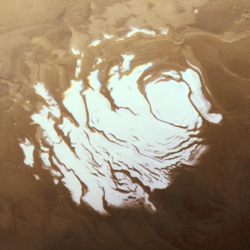
The images you are reviewing are of the south pole of Mars.
Why is Mars black and white in these images?
The Context Camera does not have multiple filters and therefore cannot take color images. With one filter, the Context Camera images show up in grayscale.
What's the resolution of the images?
Context Camera images have a spatial scale of ~6 meters per pixel.
Why do you need people to review these images? Why can't computers do this?
Identifying these different terrains is a task that computers are not good at. It turns out that people are really good at this task. Human beings can easily match patterns and identify outliers that can be difficult if not impossible to teach machines to do.
What are you going to do with my classifications I provide?
Your classifications get stored in the Zooniverse's database. Later the Planet Four: Terrains science team will combine the multiple volunteer assessments for each image, including your classifications, to identify the terrains present all across the south polar region of Mars.
Why do you need so many people to help?
With 20 people reviewing each Planet Four: Terrains image, we can accurately determine the features present. By having multiple people independently assess each image, we gain the wisdom of the crowd. It has been shown that the combined assessment of many non-experts can often equal and outperform those of experts and machine learning algorithms.
How do I know if I'm doing this right?
Trust your judgment and check out our Spotter's Guide for some more examples. Human beings are really good at tasks like this, and generally your first answer is likely the right one. So trust your gut. Multiple people review each image so chances are if you spot something in the image likely other people did too.
I made a mistake, can I go back and edit my classification?
You can change your answer before you hit the 'Done' button, but once you submit your classification you can't go back and edit it. Don't worry too much about an occasional mistake. This is one of the reasons we ask several people to review each image. Chances are the other classifiers identified the features and will correct the mistake.
I have a question or I found something interesting, who should I talk to?
You can make a post on our Talk discussion tool. With Talk, you can discuss and interact with the rest the Planet Four: Terrains community including members of the science team. After classifying an image, you can go to the image’s Planet Four: Terrains Talk page and make a comment, label the image with a hashtag, start a side discussion, or post a new thread in Talk's message board forum.
How do I keep up to date on the latest news about this project?
We will post updates on the Planet Four blog. You can also keep track of the latest news by following the Planet Four Twitter, Facebook, and Google+ accounts.
What is the original Planet Four project?
The original Planet Four project asks people to help map dark seasonal fans and blotches in images taken from orbit of Mars' South Pole in order to better study the Martian climate. You can learn more about Planet Four here.