


Research
Greenland's Weather History 1873-1957
One hundred and fifty years ago, a small group of dedicated individuals began recording the weather three times a day, every day, all year round, along the coast of Greenland. These weather instrument readings and observations were meticulously noted on paper and dispatched to the Meteorological Institute in Denmark. Subsequently, the institute compiled the observation data into Meteorological Yearbooks.
Until recently, all this valuable weather data existed only in printed books, making it inaccessible for analysis and scientific research.
Although some monthly records were digitized in the 1990s, a significant portion of data predating 1958 remains unprocessed.
Today, there's a growing interest in understanding Greenland's weather and climate and how it's changing over time. A central question is: How does the current and future climate compare to the past? To answer that, we aim to take all the detailed weather observations from those old yearbooks and add these missing pieces to each weather time series in Greenland. We want to make this historical data available to the public so that everyone can look into the past weather and use data in their analyses.
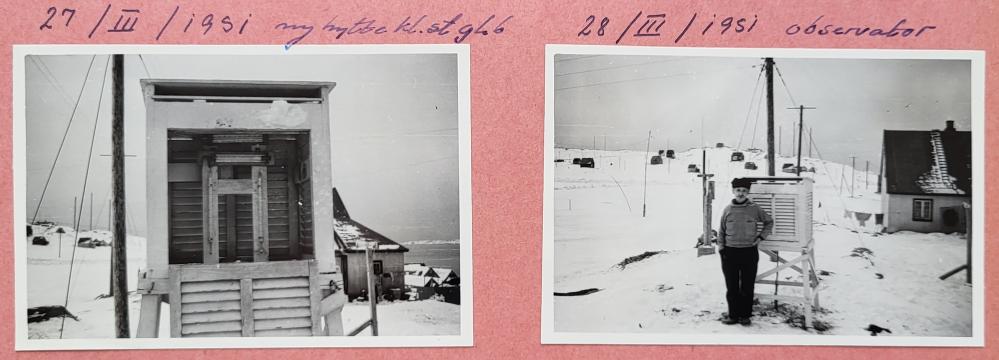
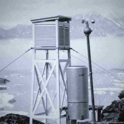
The weather station in Godthåb (Nuuk) in 1951. DMI image archive, photographer unknown.
Additionally, scientists who study Greenland's climate have been using various sources to estimate what the climate was like in the past. By including these daily observations from the old yearbooks, these climate estimations could become more accurate and reliable.
We now ask for your help to transcribe a piece of this data so we can finally unravel the old weather data from Greenland and let everyone benefit from the sustained efforts of early weather observers.
The weather station network
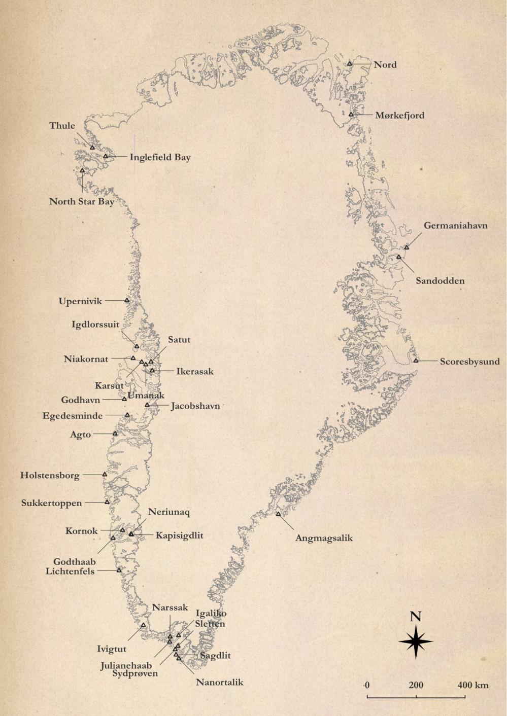
During our initial classification of the pages in the yearbooks, we found that 37 sites were operational in Greenland between 1873 and 1957. Some operated for a few years, e.g., during scientific expeditions, while others remained operational throughout the entire period.
We found that the number of pages with data was highest from the weather stations in Ilulissat ('Jakobshavn'), Nuuk ('Godthaab'), Upernavik ('Upernivik'), Ivittuut ('Ivigtut'), and Tasiilaq ('Angmagsalik'). These five stations account for almost 70 percent of the pages in this project, meaning that we will get very detailed data on the long-term changes in weather with your help.
In this project, we use the old Danish names for the Greenlandic locations to avoid confusion during transcription. Later, when we process and publish the data, we will use the modern Greenlandic town and location names instead.
The approximate locations for all the stations in this project are shown on the map below:
Where will data be used?
When data have been digitized, the climatologists from the Danish Meteorological Institute (DMI) will check the data for errors and collect the data in an accessible table format with an accompanying report summarizing the findings. In addition, DMI has a group of scientists working on climate modeling and identifying climatic trends in Greenland and the Arctic that benefit from the digitized historical weather observations:
Kristian Pagh Nielsen, Ph.D. and physicist/meteorologist at DMI:
Historical climate data play a significant role in creating reanalysis products. These products are developed by analyzing all our weather observations using a weather model. The final result is a gridded dataset that shows estimated weather parameters in a resolution ranging from 2.5 to 30 kilometers. The accuracy of these reanalysis products relies heavily on the amount and quality of input data we have. In places where we don't have a lot of data, there's more uncertainty in the results. That's why it's critical to add as much observation data as possible to make these results as precise as possible.
Adding more long-term data is especially important for Greenland because the weather observations are very sparse, combined with the fact that the Greenland Ice Sheet has substantial impact on the global sea level.
Martin Stendel, Ph.D. and climate scientist at DMI:
The yearbooks contain hundreds of thousands of weather observations, and they offer valuable insights into past storms, cold and warm spells, and rainfall in Greenland's towns and settlements. Also, the recorded meteorological data, including air pressure, wind speed, and temperature, serve as the foundation for improving climate models.
To achieve this, we use a reanalysis approach, which combines historical observations with computer-generated weather model data based on the laws of physics. This approach helps us gain an improved understanding of past climates and improves our ability to analyze extreme weather events from the past. This is crucial for us to evaluate how current and future events compare to historical records.