


Finished! Looks like this project is out of data at the moment!
CloudCatcher will be featured on the Science Scribbler Twitch Channel! Go to https://www.twitch.tv/sciencescribbler
Research
Observing our Earth
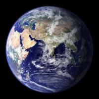
There are many satellites that orbit our Earth. You may not realise, but there is at least one satellite passing over your house every day. These satellites continually view our planet, creating images from the light or heat that it gives out. From these, scientists can derive really useful measurements of the land, oceans and atmosphere that help us to forecast the weather, monitor our climate, and gain knowledge of the planet.
Except of course when it's cloudy....
Clouds obstruct our view of the Earth’s surface and atmosphere. This happens a lot. After all, two-thirds of the Earth's surface is covered in cloud at any one time. But scientists who use these images need to know if there is cloud present. Otherwise, those clouds will affect the measurements that they are trying to make.
Cloud Masking
There are many sophisticated ways of identifying cloud, of course. We teach our computers to spot when there is a cloud in an image or not. We call this cloud masking. Most of the time the computer gets it right. But not always. Sometimes our cloud mask will miss cloud, or even, will think that clear-sky is actually cloud and the precious data over that place will be lost.
How Good?
As scientists we have to put a measurement of confidence on everything. How accurate is the cloud mask? Does it get it right 99% of the time? 80%? Does it mask all of the cloud, but at the expense of masking a lot of clear sky? We know it struggles in certain conditions, but how much? We have methods that we use to assess how well the cloud mask is doing, but these cannot be applied to entire images, and are not truly independent. Really, nothing compares to actually looking at an image to see if there is cloud present or not.
We need you!
That is where we need you. Help us to classify lots of images. In most cases, the human eye is better than a computer! We want to build up a 'human-cloud mask' that can be used to say how accurate the computer-generated mask is and point us to the conditions where the needs to be improved most. We can even use our results to help train brand new algorithms that use machine learning, but the primary goal of the project is to gather a good set of validation data. We don't need to check every single point, just a selection.
Get in orbit
The first satellite images that we are going to look at in CloudCatcher are from an instrument that flies on the Sentinel-3 satellites and is called the Sea and Land Surface Temperature Radiometer (SLSTR).
SLSTR

The primary purpose of this instrument is to measure the temperature at the surface of the ocean and land. We know the temperature of the ocean to 0.3 degrees! Every 100 minutes, SLSTR on board the Sentinel-3 satellite does an orbit of the planet, taking images as it goes. There are two satellites in orbit at the moment. We at RAL Space have been very involved in this mission. We helped calibrate these instruments prior to launch, wrote some of the instructions for processing the raw data, and validated the measurements post-launch. You could say that we are SLSTR experts!
Get ready to view some of the stunning images that this instrument has taken.
Come on, let's catch those clouds.