


Finished! Looks like this project is out of data at the moment!
Update (23 February, 2021): ALL workflows are now COMPLETE. Thank you for all your hard work over the last 15 months! Data collection for the Mapping Historic Skies Project is now COMPLETE thanks to you! https://www.zooniverse.org/projects/webster-institute/mapping-historic-skies/talk/2780/1865732?comment=3035194
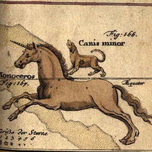
Help us identify constellations in celestial maps from the Adler Planetarium's collection
Learn moreYou can do real research by clicking to get started here!
Zooniverse Talk
Chat with the research team and other volunteers!
Mapping Historic Skies Statistics
View more statsAll Time Stats
Active Stats
Active stats provide information about currently active workflows and subjects.
Message from the researcher
Connect with the research team on Talk to learn more about this project!
About Mapping Historic Skies
Dating from the fifteenth through twentieth centuries, the Adler Planetarium's celestial cartography collection focuses on European astronomy but also includes significant examples from China and the Islamic world. The intellectual content of these maps reaches well beyond the history of astronomy. On the most fundamental level, they show relationships between objects in space. In selecting groupings of stars and other information for their maps, celestial cartographers also reveal contemporary awareness of the universe around them, as well as prior beliefs assimilated into that awareness. With a perspective embedded in time and place, the artist or astronomer understands and portrays the universe based on the surrounding society and culture. Available technologies, dominant religious sensibilities, prevailing philosophical thoughts, and popular artistic styles all influence celestial maps. From antiquity to the present day, maps of the heavens reflect terrestrial culture.