


Finished! Looks like this project is out of data at the moment!
With your help, we have finished assessing the current data from the Bahamas! If you’d like to be notified when we re-activate and to hear about further results of the project, the best way is to submit one classification while logged in (to join the project list) and make sure your email notifications for this project are turned on. Thank you.
Update: we are now active mapping road-riverbed crossings in Sudan! Visit https://www.zooniverse.org/projects/alicemead/sudan-road-access-logistics-cluster to get started. Thank you!
Research
To get started right away, click here.
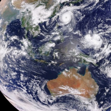
Hurricane Dorian is a strong tropical cyclone currently affecting the Bahamas and the Southeastern United States. It is the fourth named storm, second hurricane, and first major hurricane of the 2019 Atlantic hurricane season. The system gradually intensified while moving toward the Lesser Antilles, before becoming a hurricane on August 28. Rapid intensification ensued, and on August 31, Dorian intensified into a Category 4 major hurricane. On the following day, Dorian reached Category 5 intensity, peaking with one-minute sustained winds of 185 mph (295 km/h) while making landfall in Elbow Cay, Bahamas. Dorian made another landfall on Grand Bahama several hours later, near the same intensity.
This project aims to rapidly assess pre- and post-event satellite imagery, in order to produce a heat map of urgent priorities for teams involved in early recovery efforts. UK Disaster Risk Reduction and Response charity Rescue Global is deploying a team to The Bahamas to collect data on the ground. In partnership with the University of Oxford, the Planetary Response Network and Zooniverse, Rescue Global would like to obtain crowd-sourced "heat map" data of priorities from the Zooniverse community, to support their own aerial and ground reconnaissance.
We are asking volunteers to compare pre- and post-event satellite images at in order to identify the effects of the hurricane. The data analysis team will combine this with publicly available mapping and assessment data from other efforts such as those underway from the Humanitarian OpenStreetMap Team and Tomnod to provide high-quality information to Rescue Global.
As the situation evolves and the needs of responders and decision-makers evolve, this project will likely evolve too. Please check Talk for the most up-to-date information. Thank you.